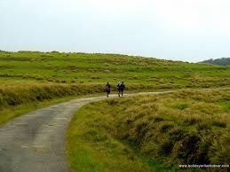
Horton Plains National Park is a protected area in the central highlands of Sri Lanka and is covered by montane grassland and cloud forest. This plateau at an altitude of 2,100–2,300 metres (6,900–7,500 ft) is rich in biodiversity and many species found here are endemic to the region. This region was designated a national park in 1988. It is also a popular tourist destination and is situated 32 kilometres (20 mi) from Nuwara Eliya and 8 kilometres (5.0 mi) from Ohiya.
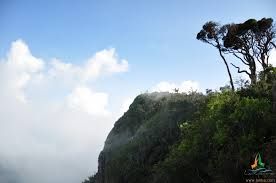
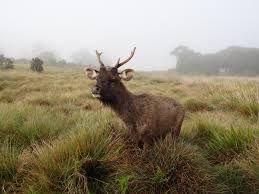
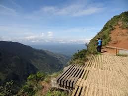
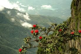
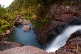
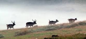
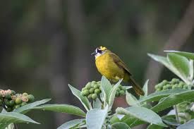
The Horton Plains are the headwaters of three major Sri Lankan rivers, the Mahaweli, Kelani, and Walawe. In Sinhala the plains are known as Maha Eliya Plains. Stone tools dating back to Balangoda culture have been found here. The plains' vegetation is grasslands interspersed with montane forest, and includes many endemic woody plants. Large herds of Sri Lankan Sambar Deer feature as typical mammals, and the park is also an Important Bird Area with many species not only endemic to Sri Lanka but restricted to the Horton Plains. Forest dieback is one of the major threats to the park and some studies suggest that it is caused by a natural phenomenon. The sheer precipice of World's End and Baker's Falls are among the tourist attractions of the park.
Horton Plains is located on the southern plateau of the central highlands of Sri Lanka.[2] The peaks of Kirigalpoththa (2,389 metres (7,838 ft)) and Thotupola Kanda (2,357 metres (7,733 ft)), the second and the third highest of Sri Lanka, are situated to the west and north respectively. The park's elevation ranges from 2,100–2,300 metres (6,900–7,500 ft).[3] The rocks found in the park belong to the Archaean age and belong to the high series of the Precambrian era and are made up of Khondalites, Charnockites and granitic gneisses.[4][5] The soil type is of the red-yellow podsolic group and the surface layer is covered with decayed organic matter.[4]
The mean annual rainfall is greater than 2,000 millimetres (79 in). Frequent cloudy cover limits the amount of sunlight that is available to plants. The mean annual temperature is 13 °C (55 °F) but the temperature varies considerably during the course of a day, reaching as high as 27 °C (81 °F) during the day time, and dipping as low as 5 °C (41 °F) at night. During the southwest Monsoon season, the wind speed sometimes reaches gale force. Although some rain falls throughout the year, a dry season occurs from January–March. The ground frost is common in February. Mist can persist in the most of the day during the wet season.[6] Many pools and waterfalls can be seen in the park, and Horton Plains is considered the most important watershed in Sri Lanka.[2] The Horton Plains are the headwaters of important rivers such as the Mahaweli, Kelani, and Walawe.[2] The plains also feeds Belihul Oya, Agra Oya, Kiriketi Oya, Uma Oya, and Bogawantalawa Oya.[6] Due to its high elevation, fog and cloud deposit a considerable amount of moisture on the land. Slow moving streams, swamps, and waterfalls are
Address
පටිටිපොළ, නුවරඑළිය, , , ශ්රී ලංකාව