හෝර්ටන් ප්ලේන්ස් ජාතික උද්යානය
Home to more than half of Sri Lanka's vertebrates, half of the island's endemic flowering plants and more than 34% of its endemic trees and shrubs, the Horton Plains is mystery cloaked and breathtaking wonder and ideal for trekking, hiking and camping. Added to the mystery and romance, one could enjoy the splendour of the leopard, the sambhur, the endemic purple-faced languor, the Sri Lanka bush warbler and the yellow-eared bulbul.
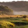
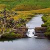
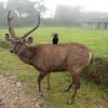
This highland is at an elevation of 2,100-2,300 metres. It is very rich in biodiversity and many species found here are endemic to the region. This region was selected a national park in 1988. It is also a popular tourist destination and is situated 32 kilometres from Nuwara Eliya. There are three main rivers heading from Horton plains Mahaweli, Kelani and Walawe. The plains' vegetation is grasslands interspersed with forest, and includes many endemic woody plants. Large herds of Sri Lankan Sambhur and Deer feature as typical mammals, and the park is also an important Bird Area with many species not only endemic to Sri Lanka but restricted to the Horton Plains. The sheer precipice of World's End and Baker's fall are among the tourist attractions of the park.
Horton plains is located between the peaks of Kirigalpotta 2389meters, Thotapalakanda 2357 metres the second and third highest mountains of Sri Lanka. The park elevation is around 2100 to 2200 metres above the sea level and the mean annual rainfall is greater than 2,000 millimetres. Frequent clouds cover the amount of sunlight that is available to plants. The mean annual temperature is 13°C but the temperature varies considerably during the course of a day, reaching as high as 27°C during the day time, and dipping as low as 5°C at night.
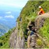
Horton plains is vital place for birders as there are many birds restricted to Horton plains and its vicinity. Endemic birds like Dull blue Flycatcher, Sri Lanka White Eye, Sri Lanka Whistling Thrush, Sri Lanka Wood Pigeon, Sri Lanka Jungle fowl Sri Lankan Spur fowl, Yellow Fronted Barbet, orange billed Babbler, Tourists are attracted mainly for Bird watching, Nature walks and see the World's End; a sheer drop of 1 kilometre down the hill is an amazing view.
Location Central province, Sri Lanka
Nearest city Nuwara Eliya and Ohiya
Coordinates 6°48′N 80°48′ECoordinates: 6°48′N 80°48′E
Area 3,160 hectares (12.2 sq mi)
Established 1969 (Nature reserve)
1988 (National park)
Governing body Department of Wildlife Conservation
World Heritage Site 2010 (within the site Central Highlands of Sri Lanka)[
Listing Details
Telephone
+94 11 242 6900


